Featured Dataset: Large Scale International Boundaries (LSIB)
The Office of the Geographer and Global Issues at the U.S. Department of State produces the Large Scale International Boundaries (LSIB) dataset. The lines generalized from this dataset are the only international boundary lines approved for use on U.S. Government maps, databases, and other geographic products such as annotated imagery. They reflect U.S. Government policy, and not necessarily de facto control. This dataset can be accessed from Geodata.state.gov, GeoPlatform.gov, or Data.gov.
Featured Data Platforms:

GeoData.state.gov
All open data published by the Office of the Geographer and Global Issues is available on GeoData.state.gov. The GeoData site is a digital service provided by the U.S. Department of State for publishing open geographic data produced by or compiled by the U.S. Government to the public, U.S. Government decision-makers, and partners.

Humanitarian Data Exchange
Open data published by the Humanitarian Information Unit is available on the United Nation’s Humanitarian Data Exchange (or HDX). HIU publishes its current data to HDX. For an archive of all open data, see Data.gov or GeoData.state.gov.

Data.Gov
All open data published by the Humanitarian Information Unit is available on Data.gov at https://catalog.data.gov/harvest/state-geodata. Data.Gov harvests from GeoData.state.gov every 24 hours.
Cartographic Guidance Bulletins
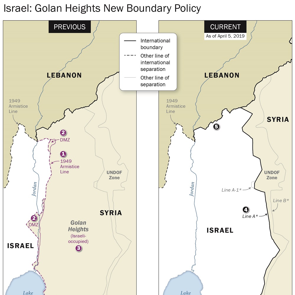
The Office of the Geographer and Global Issues at the U.S. Department of State releases periodic guidance bulletins to inform Federal cartographers of changes in mapping policy, mostly with regard to international boundary and sovereignty issues. This series of bulletins began in 1991, and the policies contained in them, where applicable, are reflected in the Large Scale International Boundaries (LSIB) dataset.